

My Sand Collection
Lubo CMOREJ
Lubo CMOREJ
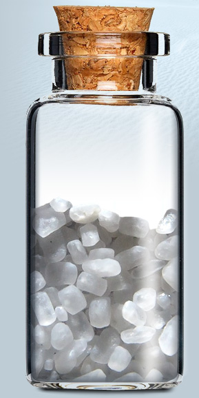
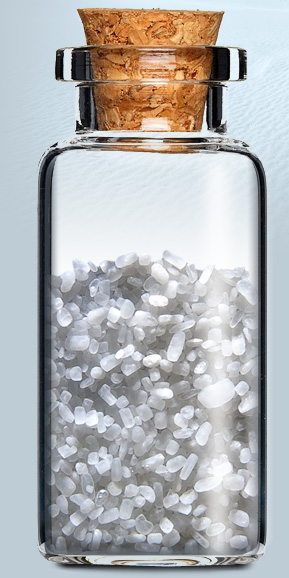
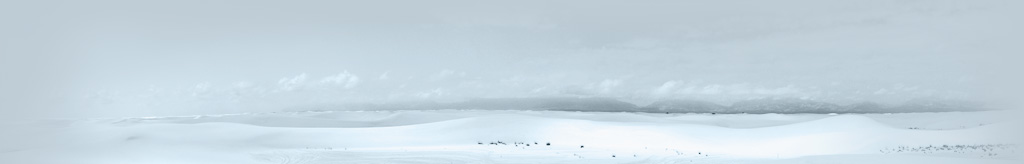
White Sands, New Mexico USA
The White Sands National Monument is a U.S. National Monument located about 25 km (16 mi) southwest of Alamogordo in western Otero County and northeastern Doña Ana County in the state of New Mexico, at an elevation of 4235 feet (1291 m). The area is in the mountain-ringed Tularosa Basin and comprises the southern part of a 710-km² (275-mi²) field of white sand dunes composed of gypsum crystals.
Gypsum is rarely found in the form of sand because it is water-soluble. Normally, rain would dissolve the gypsum and carry it to the sea. The Tularosa Basin is enclosed, meaning that it has no outlet to the sea and that rain that dissolves gypsum from the surrounding San Andres and Sacramento Mountains is trapped within the basin. Thus water either sinks into the ground or forms shallow pools which subsequently dry out and leave gypsum in a crystalline form, called selenite, on the surface. Groundwater that does flow out of the Tularosa Basin flows south into the Hueco Basin. During the last ice age, a lake known as Lake Otero covered much of the basin. When it dried out, it left a large flat area of selenite crystals which is now the Alkali Flat. Another lake, Lake Lucero, at the southwest corner of the park, is a dry lake bed, at one of the lowest points of the basin, which occasionally fills with water.
text source: wikipedia


click the dot
to see location on Google maps
to see location on Google maps


© 2013 Lubo CMOREJ


move your mouse over
the bottle for a closer view
the bottle for a closer view
To see more pictures from location visit my travel website tip66.com
